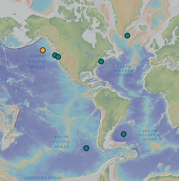
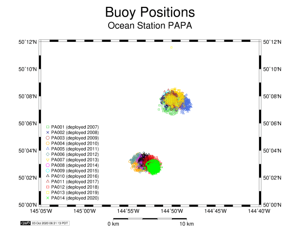
Ocean Station Papa (yellow) at 50˚N 145˚W. Other global and coastal research arrays in blue. Map: Ocean Observatories Initiative.
Today, the location is also home to several other moorings, including a Noise Reference Station (NRS02), a University of Washington Applied Physics Laboratory Waverider, and an Ocean Observatories Initiative Global Array.
This month, NOAA Ship Oscar Dyson sailed to Station Papa to deploy a new 2020 central surface mooring, noise reference station NRS02, and a waverider. We also recovered the 2019 surface mooring and NRS02, and tracked down the 2019 waverider which had broken free of its anchor, but was still transmitting its location via AIS.
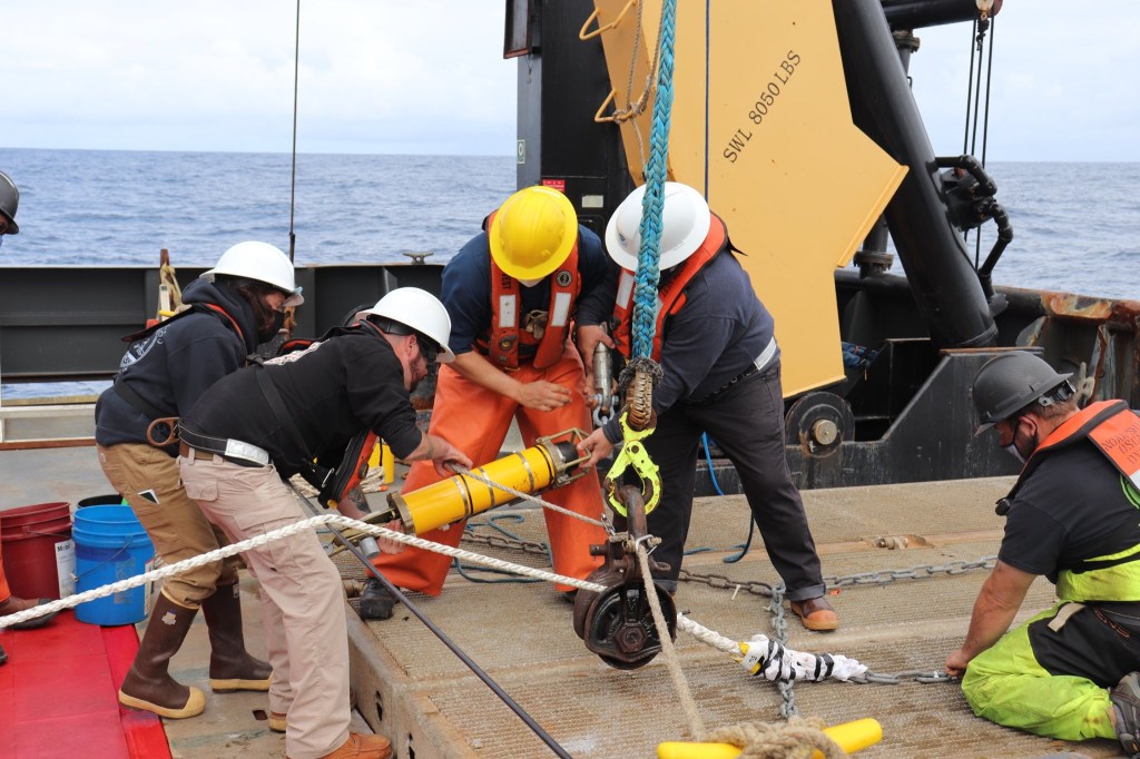
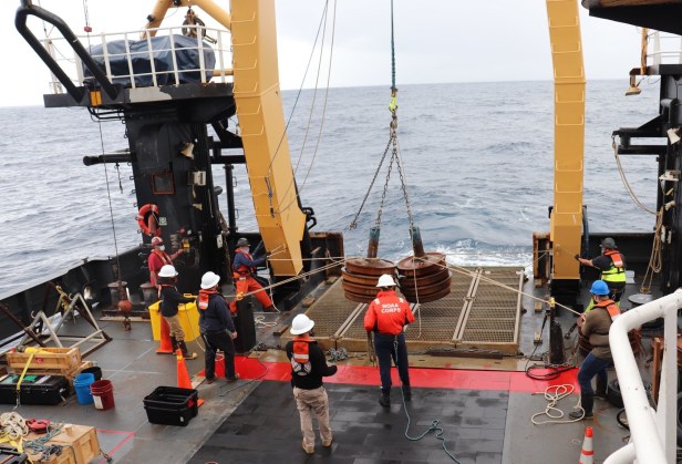
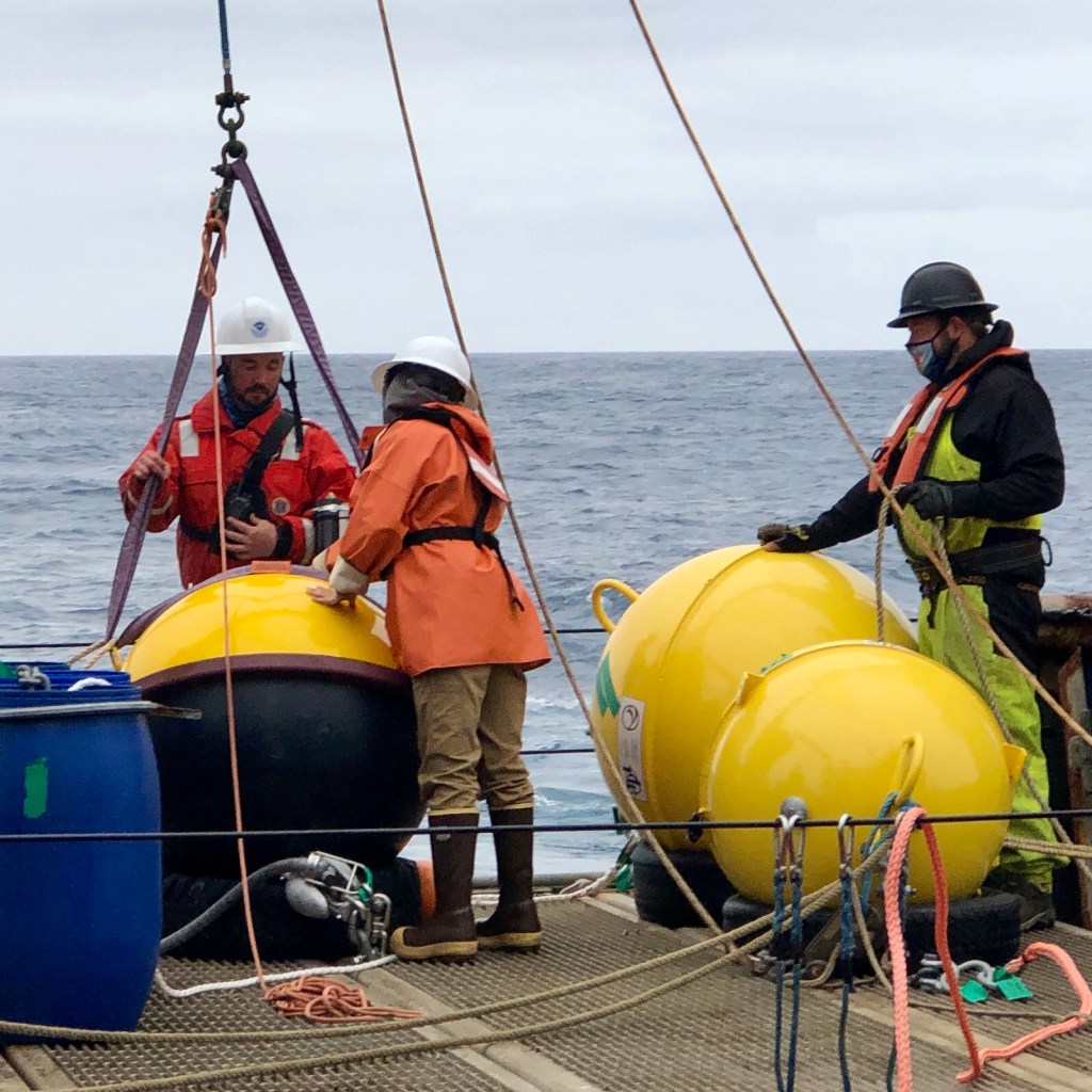
Papa, NRS02, and Waverider arrived at the NOAA Marine Operations Center in Newport, Oregon on July 25, 2020. Photo: Heather Rippman.NOAA Ship Oscar Dyson departed from Newport, Oregon on August 11, 2020. The Papa buoy on the platform, anchors (old train wheels) on deck, and thousands of meters of jacketed steel cable and nylon lines for three moorings on the net reels. Photo: Heather Rippman.Station Papa mooring diagram. PDF: NOAA PMEL.Oceanographic sensors are installed on jacketed steel cable below the mooring. Photo: LT Laura Dwyer.With some of the subsurface instruments already in the water, the surface buoy is lifted from the stern with the A-frame. Photo: LT Laura Dwyer.Dyson crew members attach additional instruments along 315 meters (1033 feet) of jacketed steel cable under the buoy. Photo: LT Laura Dwyer.The buoy will be towed behind the ship at a speed of 1.5-2 knots (about 2 miles per hour) until it is fully assembled. Ultimately, it will trail behind us on all 4200+ meters (almost 14,000 feet) of wire and nylon line that will connect it to its anchor on the sea floor. Photo: LT Laura Dwyer.This acoustic release will attach the mooring to its anchor. Next year, the ship that recovers this mooring will use a transceiver to send a code to this device and release the mooring from its anchor. We’ll do the same later on this cruise, when we recover the 2019 moorings. Photo: LT Laura Dwyer.The Papa mooring’s 6850-pound anchor is lifted onto the platform as Dyson approaches the mooring’s final position. Photo: Rodney Terry.
Once we’ve dropped the anchor, it might take 30 minutes to fall all the way to its final location on the sea floor more than 4200 meters (almost 14,000 feet) below. We’ll sail by later to take photos and record the mooring’s exact final position.
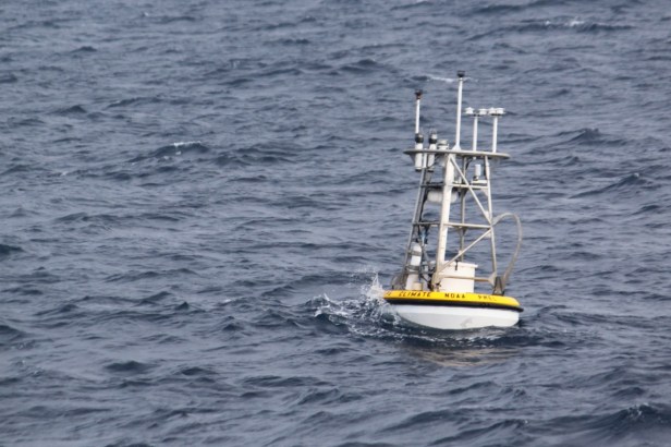
The 2020 Station Papa surface mooring after deployment on August 15, 2020. Photo: Heather Rippman.2020 Station Papa surface mooring current anchor position: 50° 2.5’N, 144° 51.9’W. Graphic: NOAA PMEL.
With the largest 2020 mooring now deployed, we have two more to release.
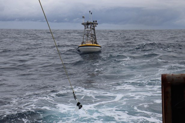
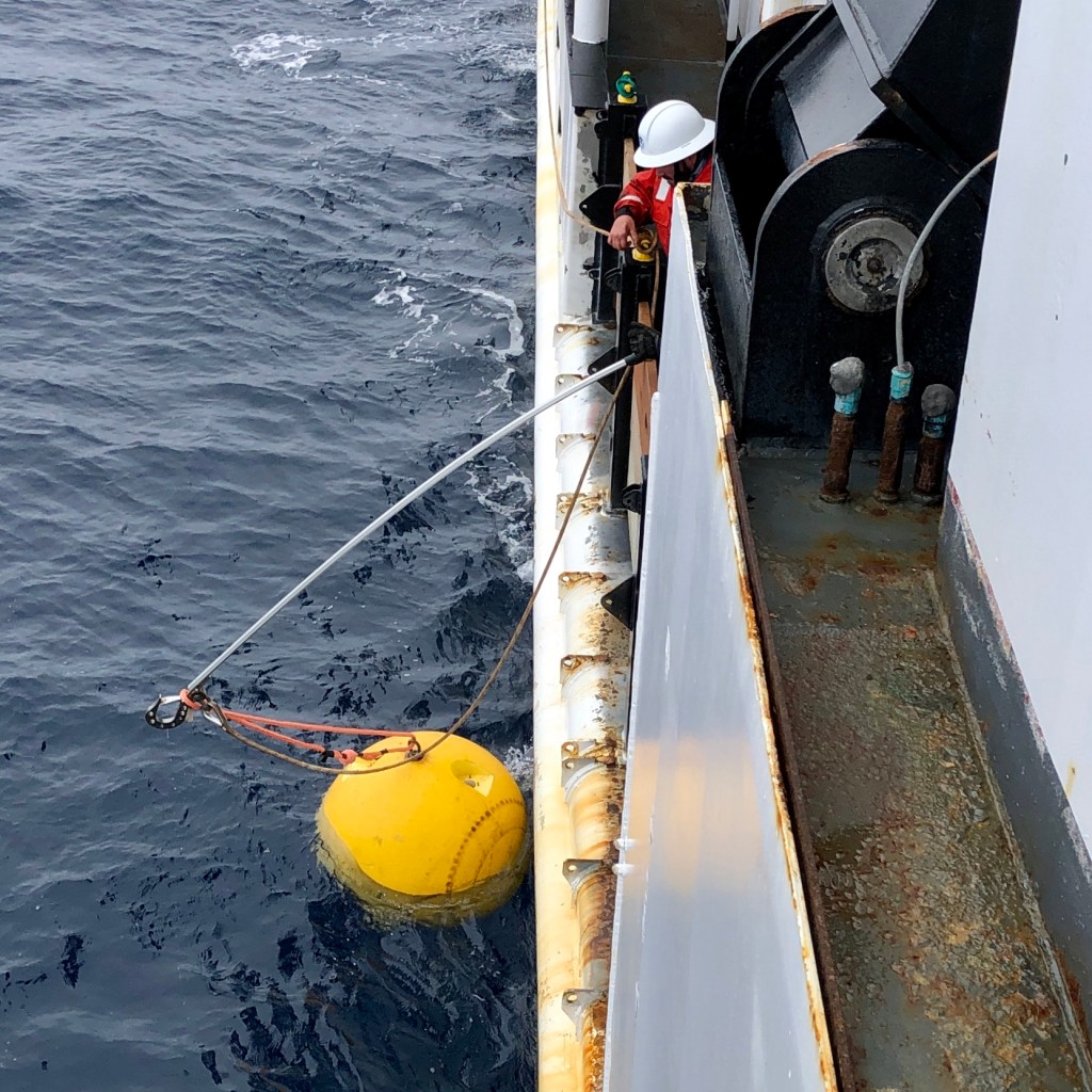
The Waverider is attached to its anchor system with a long polypropylene line, which allows freedom of movement at the surface. Photo: Heather Rippman. Diagram: UW APL.
And now, there’s space on deck to recover last year’s moorings. We used the ship’s release transducer to enable each release, check its distance from us, and then trigger it to detach from the anchor and send the moorings floating to the surface/drifting so that we could pick them up.
Communicating with the Station Papa 2019 mooring’s release. Photo: LT Laura Dwyer.
Acoustic releases from Papa and NRS. Xtratufs for scale. Photo: Heather Rippman.
After a year in the ocean, we recovered all three moorings and almost all of the subsurface sensors in pretty good condition.
Waverider recovery on NOAA Ship Oscar Dyson. August 18, 2020. Photo: Heather Rippman. NRS02 recovery on NOAA Ship Oscar Dyson. August 16, 2020. Photo: Heather Rippman.Papa surface mooring recovery on NOAA Ship Oscar Dyson. August 17, 2020. Photo: Heather Rippman.Gooseneck barnacles covered the instruments under the Station Papa surface mooring. Everyone exposes scientific instruments to conditions like these, right?! Photo: Heather Rippman. Station Papa’s 2019 subsurface instruments on NOAA Ship Oscar Dyson’s wet lab conveyor belt, with the recovered surface buoy visible outside. Photo: Heather Rippman.
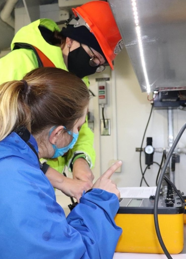
Now we’ve disassembled, cleaned, and packed them to deliver back to the NOAA Pacific Marine Environmental Laboratory (PMEL) in Seattle this weekend.
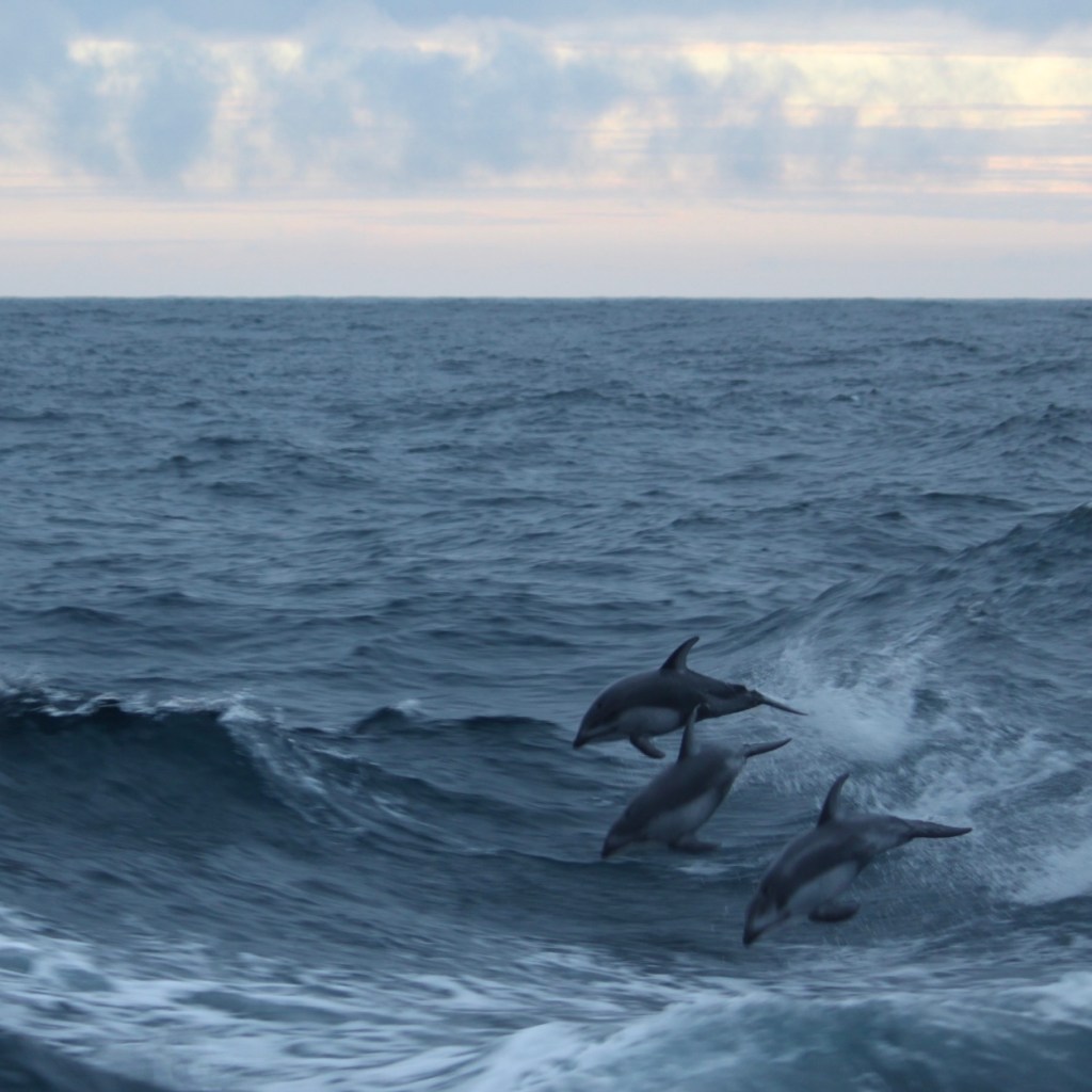
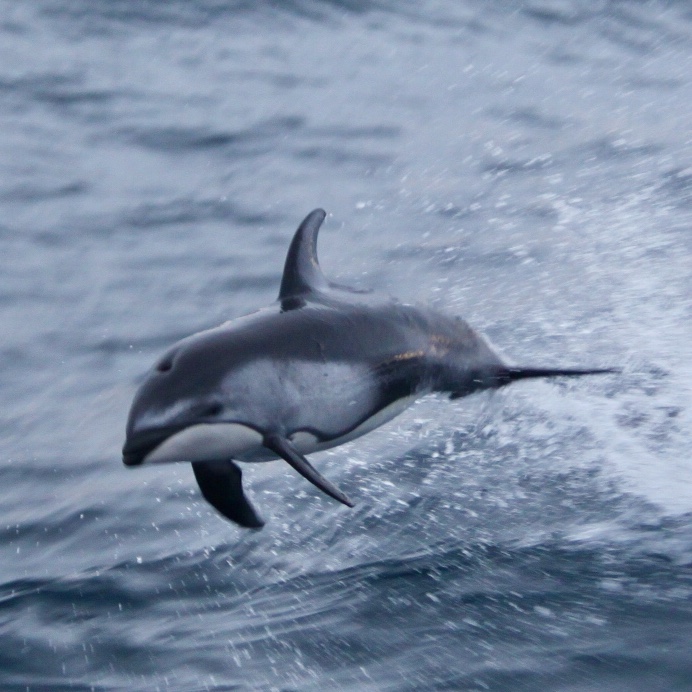
A perfect end to a successful project: A pod of beautiful, playful, athletic Pacific white-sided dolphins played in our wake for about an hour at twilight, as we approached the coast of British Columbia on our way to Seattle. Photo: Heather Rippman.Pacific white-sided dolphin off the coast of British Columbia. August 20, 2020. Photo: Heather Rippman.